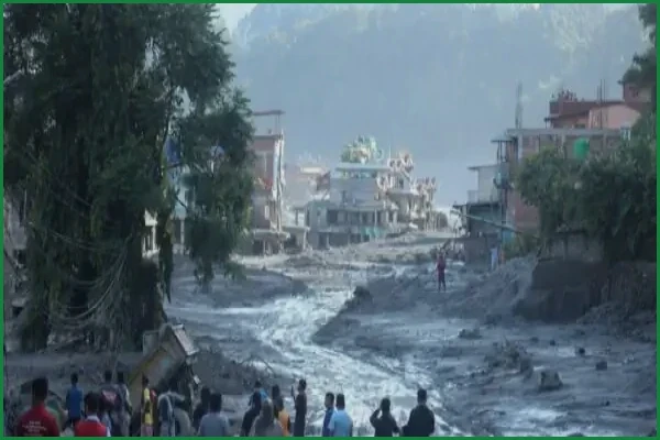
In the wake of a catastrophic flood that struck Nepal on August 26, 2026, the nation remains gripped by grief and a contentious debate over the causes of the massive death toll. With the latest figures confirming over 1,400 fatalities and 6,000 individuals still missing on the Nepali side, the disaster has prompted intense scrutiny of the country’s disaster response and early warning protocols. Dozens more are reported dead or missing in Tibet.
Initial public anger, fueled by social media, focused on accusations that China withheld critical satellite and disaster monitoring data that could have provided Nepal with essential warning time. However, the Chinese embassy in Kathmandu rejected these claims as “completely false and misleading,” asserting that Beijing had shared all relevant information with Nepali authorities in a timely manner. This perspective was bolstered by findings from the National Disaster Risk Reduction and Management Authority (NDRRMA), which pushed back against the narrative that a lack of information was the primary failure.
A technical reconstruction published by researchers at the Chinese Academy of Sciences’ Institute of Mountain Hazards and Environment provided further context. The study identified that a glacier on the south slope of Langtang Lirung, situated at an elevation of approximately 5,200 meters, fractured at 10:52 a.m. China time (8:47 a.m. in Nepal) on August 26. The resulting ice-rock avalanche transformed into a debris flow, traveling 22 kilometers to reach Gyirong Port on the Chinese side in about seven minutes. Researcher Su Pengcheng noted that the debris reached speeds averaging nearly 50 meters per second, leaving virtually no window for effective warning or reaction. The collapse was attributed to long-term glacier instability caused by climate warming rather than specific, trackable weather patterns.
While the immediate debate centers on information sharing, the disaster has forced a deeper examination of Nepal's sovereign capacity to monitor such hazards. Many survivors and local officials reported that while they were aware a flood was imminent, the speed of the event made evacuation impossible. Experts are now questioning whether Nepal can continue to rely on external satellite and monitoring infrastructure that it does not own. As Nepal becomes increasingly exposed to climate-driven disasters, the ability to maintain independent, real-time monitoring systems has become a critical issue for the safety of millions in the Himalayan region. Meanwhile, both governments warn that the danger is not over, as a barrier lake remains at the collapse site, leaving the possibility of a second flood open.
People gather to look at the damage after a massive flood in the Bhotekoshi River in Nuwakot, Nepal, Aug. 28, 2026.
You have reached the limit of 2 free articles this month.
Related Articles

Md. Kazi Bijoy is a dedicated tech enthusiast and content creator with a passion for digital innovation. With years of experience in the tech industry, he specializes in breaking down complex topics into easy-to-understand guides. When he isn’t writing, he explores the latest gadgets and researches emerging trends in the digital world.