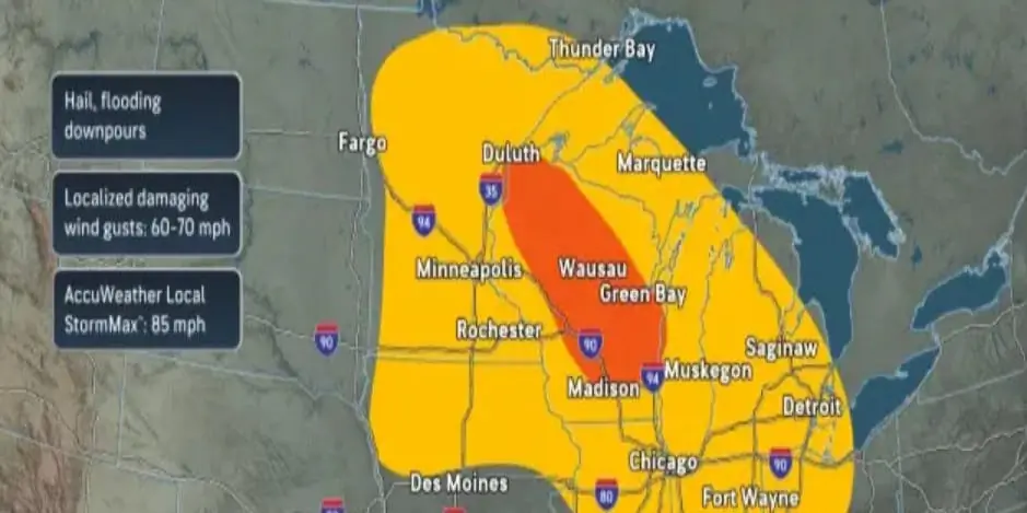
A powerful storm system is sweeping across the northern United States, threatening to unleash severe thunderstorms, damaging winds, and flash flooding from the Midwest to the East Coast. Forecasters warn that the widespread weather system, which began pushing through eastern Minnesota and northern Wisconsin, could severely impact Monday evening commutes with sudden downpours and high winds.
The Great Lakes and Ohio Valley are facing the highest risk of severe weather. The storms are developing along the northern edge of a massive heat dome sitting over the Plains, fueled by intense heat and humidity. By Sunday evening, meteorologists expected the system to intensify into a broad line of storms capable of producing heavy rain and "wide swaths of damaging wind gusts" reaching up to 85 miles per hour as they push southeastward.
AccuWeather meteorologist Brandon Buckingham explained the challenges of forecasting the system's exact path. "Day-to-day thunderstorm activity can sometimes rely on where previous rounds of thunderstorms develop, which makes pinning down the exact location of the highest risk for severe weather difficult until just a matter of hours before storms form," Buckingham said.
The storm system has already demonstrated its destructive potential. On Saturday night, it battered Sioux Falls, South Dakota, with 80-mile-per-hour winds, while gusts surpassed 90 miles per hour on the city's southern outskirts, knocking out power to thousands of residents. As the system moves east, the National Weather Service warned that more power outages and fallen tree limbs are likely, with lightning and heavy downpours expected to arrive by Monday afternoon and evening.
The severe weather is projected to advance into the Northeast and mid-Atlantic regions, causing potential travel disruptions along the busy Interstate 95 corridor from New York City to Raleigh, North Carolina. Damaging wind gusts, hail, and torrential rain are all expected. Additionally, prolonged heavy rainfall on the northern edge of the storm is forecast to persist through Tuesday evening, raising the risk of flash flooding in areas stretching from Buffalo to Boston. By Wednesday, the threat of severe weather and urban flash flooding will extend into parts of New England, particularly in low-lying areas with poor drainage.
Meanwhile, a dangerous heat wave continues to grip the central and southern United States. The National Weather Service reported that afternoon temperatures on Sunday and Monday will climb into the upper 90s and lower 100s. Heat indices are projected to soar between 105 and 115 degrees across parts of the Rockies, the Plains, the Mississippi Valley, and portions of the South.
Related Articles

Md. Kazi Bijoy is a dedicated tech enthusiast and content creator with a passion for digital innovation. With years of experience in the tech industry, he specializes in breaking down complex topics into easy-to-understand guides. When he isn’t writing, he explores the latest gadgets and researches emerging trends in the digital world.
1 thought on “Severe Storms and Extreme Heat Threaten Midwest and East Coast”